Press Releases
16-12-2021 13:06
Climate Watch Advisory for abnormal weather conditions for the Eastern Mediterranean: High precipitation accumulation
Issue: 15/12/2021, 1200 Local Time
Validity: 15/12/2021 to 4/1/2022
According to the 202117 Advice of the Climate Watch Advisory Group of the World Meteorological Organization WMO[1], abnormal accumulated precipitation is forecasted for the next three weeks over the Eastern Mediterranean with forecast probability exceeding 90% for the first week, 70% for the second week and close to 60% over the third period. The weekly accumulation of precipitation is expected to range from 10 to 30 mm above the normal. Increased snowfall is also forecasted. High risk of flooding over lowlands and drainage basins.
The following weather chart is the height pattern of the 500hpa isobaric surface at around 6000 meters. The atmosphere over Europe is clearly separated into two distinctive parts: The anticyclonic area with high temperatures (West and Central Europe, yellow color) and the cyclonic area with low temperatures. This pattern favors the entrapment of cold air mass over eastern Mediterranean that will drive the weather conditions over the next three weeks.
The next weather chart illustrates the weather systems that prevail on 16/12 at 12UTC with a weak barometric low connected to the upper low over the higher atmosphere and the lack of any weather feature in west, east and central Europe.
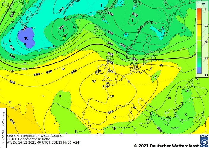
Height pattern at the 500hpa isobaric surface 16/12/2021 for 1200 UTC (Source: German Meteorological Service DWD)
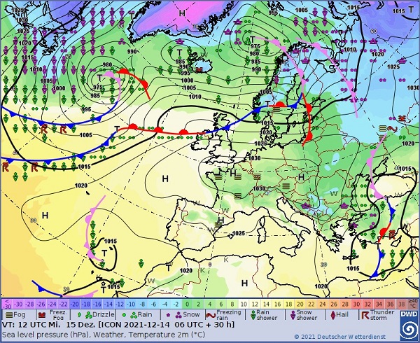
Surface Weather Patterns on 16/12/2021 for 1200UTC (Source: German Meteorological Service DWD)
EH/ΙΚ
[1] The forecasts are based on the German Meteorological Service (DWD) climate model, the Climate Model of the French Meteorological Service (MeteoFrance) and the European Centre of Medium-range Weather Forecast (ECMWF) climate model.
Relevant Press Releases
22-03-2024 11:17
Monthly Weather Report: February 2024